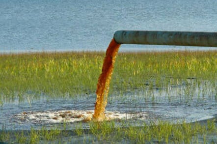
WI DNR adds 2 more waterways to state's impaired list
I'd earlier posted information about the skyrocketing number of Wisconsin waterways, principally due to phosphorous pollution because the state has relaxed its phosphorous discharge rules

that the state had reported, as required, to the US EPA in a biennial filing.
Regrettably, the final impaired list shows no additional waterways removed from the list, a new increase of two as explained below in the yellow indicating how the DNR's webpage has changed.

that the state had reported, as required, to the US EPA in a biennial filing.
Regrettably, the final impaired list shows no additional waterways removed from the list, a new increase of two as explained below in the yellow indicating how the DNR's webpage has changed.
Wisconsin’s 2018 impaired waters list
Every two years, Section 303(d) of the Clean Water Act requires states to publish a list of all waters that are not meeting water quality standards. In the proposed 2018 list update, DNR proposes to add 242 240 new waterbody water segments. A majority of the listing additions were waters that exceed total phosphorus criteria. Thirty-five waterbodies are proposed to be delisted. A 30-day public comment period was held started on November15, 2017 through and has been extended to January 8, 2018. The final documents are listed below and some of the information found Comments can be viewed on emailed to the DNR at DNRImpairedWaters@wisconsin.gov , or sent by U.S. mail to Ashley Beranek, DNR, Water Evaluation Section (WY/3), Box 7921, Madison, WI 53707 . Comments emailed, postmarked, or received by January 8, 2018 Water QualityReportwill be considered before submitting the final draft list to Congress webpagethe U.S. Environmental Protection Agency for approval.
Final2018impairedwaterslistmaterialsPublic Comment Materials
- WisconsinDraft 2018 Water Quality Report to Congress Impaired Waters List [PDF]
- Clean Water Act Report to Congress Executive SummaryFactsheet on Assessing Wisconsin’s Waters [PDF]
- Final draft 2018 impaired waters list [Excel]
- Response to Public CommentsFactsheet on 2018 Draft impaired waters listImpaired Waters List Updates [PDF]
- Assessment methods used to develop the impaired waters listFactsheet on Impaired Waters Listing Process [PDF]
- Framework for prioritizing listings for restoration plan development [PDF]
- Two-Story Fishery Lake list [PDF]
Dataviewingtools
- The Impaired waters search toolWaters Search Tool [go to application]may be used to search DNR’sWATERS databasefor previous and current and previous impaired waterslistings, as well as listing update proposals. A help guide for using the search tool [PDF] is available.
- The Surface Water Data Viewer [go to application] can be used to search for impaired waters listings and proposed listings in an interactive mapping application. To view impaired waters on the map, click the “Show Layers” button to expand the “Impairments and Assessments” grouping and check the “Impaired Waters Status” layer. The definitions of the listing status categories are provided here [PDF].
Factsheets
- Fact sheet describing proposed listing updates [PDF]
- Assessing Wisconsin's Waters: How Healthy Are Our Lakes, Rivers, and Streams? [PDF]
- Factsheet on Impaired Waters Listing Process [PDF]
Contact information
- For information contact:
- Impaired Waters Program


No comments:
Post a Comment