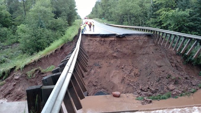
WI flood warnings persist, as does Walker's self-promotion
Walker's official Twitter account leads right now with several self-serving posts about various grant programs, including:
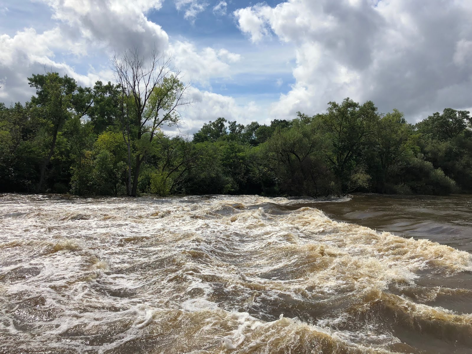
effective through Sunday along several state rivers, including this highlight:
58 min Over $94 million returned to thousands of hardworking families throughout Wisconsin thanks to our $100 Per-Child Tax Rebate!Looks like he's back on that state airplane, too.
3 hrs “Scott Walker announces statewide grants in Oconto Falls”And his personal Twitter account showed him far from floodwaters, and any mention of the Foxconn flood:
53 min Spent the morning in Sheboygan touring VPI Corporation to hear how Foxconn is having a direct impact on their workers and business! They’re in a great location too -- a block away from Lake Michigan!For the real news, check out the detailed National Weather Service very recent flood warnings
effective through Sunday along several state rivers, including this highlight:
National Weather Service Milwaukee/Sullivan WI
1147 AM CDT Thu Sep 6 2018
...The Flood Warning continues for the following rivers in Wisconsin...
  Baraboo River
    at Rock Springs
    at West Baraboo
    near Baraboo
...
1147 AM CDT Thu Sep 6 2018.
The Flood Warning continues for The Baraboo River At Rock Springs.
* At 11:15 AM Thursday the stage was 26.4 feet.
* Flood stage is 18.5 feet.
* Major flooding is occurring and Major flooding is forecast.
* Forecast.The river is forecast to continue rising to near 27.0
  feet by this evening. The river should fall below flood stage by Sunday evening.
Flood Warning
Flood Statement
National Weather Service Milwaukee/Sullivan WI
1147 AM CDT Thu Sep 6 2018

...The Flood Warning continues for the following rivers in
Wisconsin...

  Baraboo River
    at Rock Springs
    at West Baraboo
    near Baraboo

&&
WIC111-070446-
/O.EXT.KMKX.FL.W.0060.000000T0000Z-180910T0651Z/
/RSPW3.3.ER.180829T1830Z.180831T0545Z.180910T0051Z.NO/
1147 AM CDT Thu Sep 6 2018

The Flood Warning continues for
  The Baraboo River At Rock Springs.
* At 11:15 AM Thursday the stage was 26.4 feet.
* Flood stage is 18.5 feet.
* Major flooding is occurring and Major flooding is forecast.
* Forecast...The river is forecast to continue rising to near 27.0
  feet by this evening. The river should fall below flood stage by Sunday
  evening.
* Impact...At 23.0 feet...Floodwaters touch the base of the river
  gauge house in Rock Springs. Floodwaters cover much of Highways DD,
  154 and 136 in Rock Springs.  Busser Park along Highway 136 and the
  baseball diamond in Fireman`s Park along Highway DD are covered
  with water up to 4 feet deep.  Floodwaters affect some businesses,
  including the Post Office, along Highway 154 in Rock Springs.

&&

LAT...LON 4349 8998 4353 8990 4350 8986 4348 8982 4343 8990 4346 8997

$$
Flood Statement
National Weather Service Milwaukee/Sullivan WI
1147 AM CDT Thu Sep 6 2018

...The Flood Warning continues for the following rivers in
Wisconsin...

  Baraboo River
    at Rock Springs
    at West Baraboo
    near Baraboo

&&
WIC111-070446-
/O.EXT.KMKX.FL.W.0061.000000T0000Z-180911T0807Z/
/BABW3.3.ER.180830T1410Z.180908T0000Z.180911T0207Z.NO/
1147 AM CDT Thu Sep 6 2018

The Flood Warning continues for
  The Baraboo River Near Baraboo.
* At 10:00 AM Thursday the stage was 21.5 feet.
* Flood stage is 16.0 feet.
* Minor flooding is occurring and Major flooding is forecast.
* Forecast...The river is expected to continue rising to near 25.0
  feet by tomorrow evening. The river should fall below flood stage
  by Monday evening.
* Impact...At 24.6 feet... Floodwaters affect a trailer rental
  business, a wayside park, and an auto auction business about 5
  miles downstream of the gauge near the Highway 33 bridge.

&&

LAT...LON 4342 8965 4351 8967 4353 8964 4354 8957 4349 8945 4347 8957

$$

&&

River forecasts are available for some but not all river gaging
locations. The 7 day river forecast takes into account past
precipitation, soil moisture conditions, and predicted
precipitation for the basin. Precipitation is for the next 24 hours
in the future from April through September and for 48 hours in the
future from October through March.

(stages in ft.)        Bank-      Latest         Forecast stages
-               Flood  full      observed        ...for 6 pm...
Location       stage  stage    stage/time       Thu  Fri  Sat  Sun
Baraboo         16.0  14.0  21.48 10 AM 09/06  22.8 25.0 24.3 21.5
West Baraboo     9.0   7.0   9.89 11 AM 09/06  10.5 10.8  9.5  7.5
Rock Springs    18.5  13.5  26.40 11 AM 09/06  27.0 25.2 22.6 18.6

-                   Highest      24 hour change
-                   observed     in river stage
-                   stage in      (ft.) up to      Highest stage
-                   the last    latest observed     forecast in
-                   7 days          stage           next 7 days
Baraboo         24.47  06 AM 09/02    1.03      25.00 07 PM 09/07
West Baraboo    10.76  06 AM 09/01    2.23      11.00 07 AM 09/07
Rock Springs    27.12  01 AM 08/31       M      27.00 07 PM 09/06

Below is the latest predicted precipitation information in 6 hour
increments for the listed sites. This information is updated twice
daily - in the morning and evening. Precipitation prediction is for
48 hours into the future from October through March and for 24
hours into the future from April through September.

West Baraboo: 6 am-noon  Thu Sep 06  0.00
West Baraboo: noon-6 pm  Thu Sep 06  0.00
West Baraboo: 6 pm-midn  Thu Sep 06  0.00
West Baraboo: midn-6 am  Fri Sep 07  0.00
West Baraboo: 6 am-noon  Fri Sep 07  0.00
West Baraboo: noon-6 pm  Fri Sep 07  0.00
West Baraboo: 6 pm-midn  Fri Sep 07  0.00
West Baraboo: midn-6 am  Sat Sep 08  0.00

Baraboo: 6 am-noon  Thu Sep 06  0.00
Baraboo: noon-6 pm  Thu Sep 06  0.00
Baraboo: 6 pm-midn  Thu Sep 06  0.00
Baraboo: midn-6 am  Fri Sep 07  0.00
Baraboo: 6 am-noon  Fri Sep 07  0.00
Baraboo: noon-6 pm  Fri Sep 07  0.00
Baraboo: 6 pm-midn  Fri Sep 07  0.00
Baraboo: midn-6 am  Sat Sep 08  0.00

Rock Springs: 6 am-noon  Thu Sep 06  0.00
Rock Springs: noon-6 pm  Thu Sep 06  0.00
Rock Springs: 6 pm-midn  Thu Sep 06  0.00
Rock Springs: midn-6 am  Fri Sep 07  0.00
Rock Springs: 6 am-noon  Fri Sep 07  0.00
Rock Springs: noon-6 pm  Fri Sep 07  0.00
Rock Springs: 6 pm-midn  Fri Sep 07  0.00
Rock Springs: midn-6 am  Sat Sep 08  0.00
Flood Statement
National Weather Service Milwaukee/Sullivan WI
1147 AM CDT Thu Sep 6 2018

...The Flood Warning continues for the following rivers in
Wisconsin...

  Baraboo River
    at Rock Springs
    at West Baraboo
    near Baraboo

&&
WIC111-070446-
/O.EXT.KMKX.FL.W.0081.000000T0000Z-180909T1200Z/
/BBOW3.2.ER.180906T0802Z.180907T1200Z.180909T0600Z.NO/
1147 AM CDT Thu Sep 6 2018

The Flood Warning continues for
  The Baraboo River At West Baraboo.
* At 11:00 AM Thursday the stage was 9.9 feet.
* Flood stage is 9.0 feet.
* Minor flooding is occurring and Moderate flooding is forecast.
* Forecast...The river is forecast to continue rising to near 11.0
  feet by tomorrow morning. The river should fall below flood stage by
  Sunday morning.
* Impact...At 12.0 feet...There is widespread lowland and
  agricultural land flooding in the Baraboo area. Floodwaters spread
  into the lower portions of Haskins Park in West Baraboo in the area
  of the gauge.

&&

LAT...LON 4343 8990 4356 8988 4352 8974 4353 8966 4344 8960 4342 8978

$$
Flood Statement
National Weather Service Milwaukee/Sullivan WI
1115 AM CDT Thu Sep 6 2018

...The Flood Warning continues for the following rivers in
Wisconsin...

  Baraboo River
    at La Valle
    at Reedsburg
    at Rock Springs
    at West Baraboo
    near Baraboo

&&
WIC111-070415-
/O.CON.KMKX.FL.W.0083.000000T0000Z-000000T0000Z/
/RBGW3.3.ER.180904T1600Z.180905T1930Z.000000T0000Z.NO/
1115 AM CDT Thu Sep 6 2018

The Flood Warning continues for
  The Baraboo River At Reedsburg.
* At  9:30 AM Thursday the stage was 18.8 feet.
* Flood stage is 14.0 feet.
* Major flooding is occurring...
* Forecasts are not issued for this location. This warning will
  remain in effect until the river falls below flood stage.
* Impact...At 19.0 feet...Floodwaters affect Granite Avenue and South
  Webb Avenue along the river. Floodwaters are 2 feet deep in the
  Public Works Building. South Park next to the wastewater plant is
  underwater. Floodwaters are into the swimming pool control room in
  Webb Park. Floodwaters are 5 to 5.5 feet deep in the Public Works
  Yard.

&&

LAT...LON 4354 9011 4358 9004 4355 8996 4352 8991 4348 8998 4352 9006

$$
Flood Statement
National Weather Service Milwaukee/Sullivan WI
1115 AM CDT Thu Sep 6 2018

...The Flood Warning continues for the following rivers in
Wisconsin...

  Baraboo River
    at La Valle
    at Reedsburg
    at Rock Springs
    at West Baraboo
    near Baraboo

&&
WIC111-070415-
/O.CON.KMKX.FL.W.0082.000000T0000Z-000000T0000Z/
/LAVW3.2.ER.180904T1132Z.180905T0830Z.000000T0000Z.NO/
1115 AM CDT Thu Sep 6 2018

The Flood Warning continues for
  The BARABOO RIVER at La Valle.
* At  7:00 AM Thursday the stage was 16.3 feet.
* Flood stage is 15.0 feet.
* Minor flooding is occurring...
* Forecasts are not issued for this location. This warning will
  remain in effect until the river falls below flood stage.
* Impact...At 15.0 feet...Between stages 12 feet and 18 feet, there
  is lowland flooding in the La Valle area.
&&

LAT...LON 4359 9019 4363 9014 4361 9010 4358 9004 4354 9011 4356 9014

$$
Flood Statement
National Weather Service Milwaukee/Sullivan WI
1056 AM CDT Thu Sep 6 2018

...The Flood Warning continues for the following rivers in
Wisconsin...

  Rock River at
    Watertown
    Jefferson
    Fort Atkinson
    near Lake Koshkonong
    Newville
    Afton

  Fox River (North)
    at Princeton
    near Berlin

  Fox River (South)
    at Waukesha
    near New Munster

  Pecatonica River at
    Martintown

  East Branch of the Pecatonica River
    near Blanchardville

  Sugar River at
    Brodhead

  Crawfish River at
    Milford

&&
WIC065-070355-
/O.EXT.KMKX.FL.W.0087.000000T0000Z-180908T0000Z/
/BCHW3.1.ER.180906T0255Z.180906T1800Z.180907T1200Z.NO/
1056 AM CDT Thu Sep 6 2018

The Flood Warning continues for
  The East Branch Pecatonica River Near Blanchardville.
* At 8 AM Thursday the stage was 12.1 feet.
* Flood stage is 11.0 feet.
* Minor flooding is occurring and Minor flooding is forecast.
* Forecast...The river is forest to crest near 12.4 feet this afternoon
  and fall below flood stage Friday morning.
* Impact...At 12.8 feet...Highway H is flooded and closed. Floodwaters
  completely fill McKellar Park, the tennis courts and football field in Blanchardville.

&&

LAT...LON 4283 8992 4284 8984 4279 8981 4272 8984 4272 8991 4279 8991

$$
Flood Statement
National Weather Service Milwaukee/Sullivan WI
1056 AM CDT Thu Sep 6 2018

...The Flood Warning continues for the following rivers in
Wisconsin...

  Rock River at
    Watertown
    Jefferson
    Fort Atkinson
    near Lake Koshkonong
    Newville
    Afton

  Fox River (North)
    at Princeton
    near Berlin

  Fox River (South)
    at Waukesha
    near New Munster

  Pecatonica River at
    Martintown

  East Branch of the Pecatonica River
    near Blanchardville

  Sugar River at
    Brodhead

  Crawfish River at
    Milford

&&
WIC055-070355-
/O.CON.KMKX.FL.W.0073.000000T0000Z-000000T0000Z/
/JFFW3.2.ER.180904T0215Z.180908T0600Z.000000T0000Z.NO/
1056 AM CDT Thu Sep 6 2018

The Flood Warning continues for
  The Rock River At Jefferson.
* At 9:15 AM Thursday the stage was 11.3 feet.
* Flood stage is 10.0 feet.
* Moderate flooding is occurring and Moderate flooding is forecast.
* Forecast...The river is forecast to have a broad crest near 12.1 feet
  from Friday night through Monday night.
* Impact...At 12.0 feet...Riverview Drive is closed due to
  floodwaters on the road. The Tensfeldt Park boat launch is closed.
  Floodwaters affect highway K between Jefferson and Fort Atkinson.

&&

LAT...LON 4304 8886 4304 8876 4300 8876 4297 8878 4297 8887 4301 8887

$$
Flood Statement
National Weather Service Milwaukee/Sullivan WI
1056 AM CDT Thu Sep 6 2018

...The Flood Warning continues for the following rivers in
Wisconsin...

  Rock River at
    Watertown
    Jefferson
    Fort Atkinson
    near Lake Koshkonong
    Newville
    Afton

  Fox River (North)
    at Princeton
    near Berlin

  Fox River (South)
    at Waukesha
    near New Munster

  Pecatonica River at
    Martintown

  East Branch of the Pecatonica River
    near Blanchardville

  Sugar River at
    Brodhead

  Crawfish River at
    Milford

&&
WIC045-070355-
/O.EXT.KMKX.FL.W.0075.000000T0000Z-180909T1200Z/
/MTNW3.1.ER.180905T1930Z.180907T0000Z.180909T0600Z.NO/
1056 AM CDT Thu Sep 6 2018

The Flood Warning continues for
  The Pecatonica River At Martintown.
* At 8 AM Thursday the stage was 13.9 feet.
* Flood stage is 13.5 feet.
* Minor flooding is occurring and Minor flooding is forecast.
* Forecast...The river is forecast to have a broad crest from this
  evening through Friday near 14.1 feet and then fall below flood stage
  Saturday night.
* Impact...At 13.5 feet...Floodwaters affect Martintown Road and West
  River Road in the Martintown area. Upstream in Browntown,
  floodwaters affect highway MM and West Indies Road.

&&

LAT...LON 4272 8992 4272 8984 4263 8980 4251 8970 4251 8988 4260 8993

$$
Flood Statement
National Weather Service Milwaukee/Sullivan WI
1056 AM CDT Thu Sep 6 2018

...The Flood Warning continues for the following rivers in
Wisconsin...

  Rock River at
    Watertown
    Jefferson
    Fort Atkinson
    near Lake Koshkonong
    Newville
    Afton

  Fox River (North)
    at Princeton
    near Berlin

  Fox River (South)
    at Waukesha
    near New Munster

  Pecatonica River at
    Martintown

  East Branch of the Pecatonica River
    near Blanchardville

  Sugar River at
    Brodhead

  Crawfish River at
    Milford

&&
WIC045-105-070355-
/O.EXT.KMKX.FL.W.0079.000000T0000Z-180910T0000Z/
/BROW3.1.ER.180904T0535Z.180906T1315Z.180909T1800Z.NO/
1056 AM CDT Thu Sep 6 2018

The Flood Warning continues for
  The Sugar River At Brodhead.
* At 8:15 AM Thursday the stage was 6.6 feet.
* Flood stage is 5.0 feet.
* Minor flooding is occurring and Minor flooding is forecast.
* Forecast...The river is currently cresting and is forecast to have
  a secondary crest near 6.3 feet Friday night and then fall below
  flood stage Sunday afternoon.
* Impact...At 6.5 feet...There is widespread flooding of lowland and
  agricultural land. Downstream in the Avon Bottoms area of Rock
  County, there is flooding in Sugar River Park. Some roads are
  flooded in Avon Township, about 6 miles downstream of Brod